Explore mapping resources within the Blackstone Watershed and our region
Blackstone Collaborative Interactive Base Map

Explore GIS data throughout the Blackstone Watershed!
With aggregated datasets from both MA and RI, this map is intended to help partners understand the geographic context of a specific site, view the location of culverts in a municipality, or visualize a specific dataset watershed-wide.
Story Maps
Learn about the comprehensive water quality monitoring program in the Blackstone River designed to assess the river’s response to wastewater treatment facility upgrades and changes.
Learn more about Upper Blackstone River monitoring and see previous years’ storymaps here.

Upper Blackstone Clean Water’s River Quality Monitoring Program (2021)

Massachusetts Forest Action Plan
The MA State Forest Action Plan was created by the MA DCR in 2021. Want to learn more? Click through the StoryMap!

Watershed-scale Climate Collaboration
Explore the different watershed-scale climate collaboratives (WSSC) working in Massachusetts (including the Blackstone Collab!), including highlighted projects and advice for new groups.
Check out the full WSSC toolkit from MassECAN here.
Building Community Resilience Through Local Regulations

Discover how your community can utilize Mass Audubon's Bylaw Review tool in order to implement more nature-based solutions and increase climate resilience.
Check out this overview recording for more details!

Environmental Justice in the Narragansett Bay Region
Find out how socioeconomic inequities and environmental impacts are linked in the Narragansett Bay Region.
Check out the full EJ mapping tool here and get involved with NBEP’s Vision2032 here.
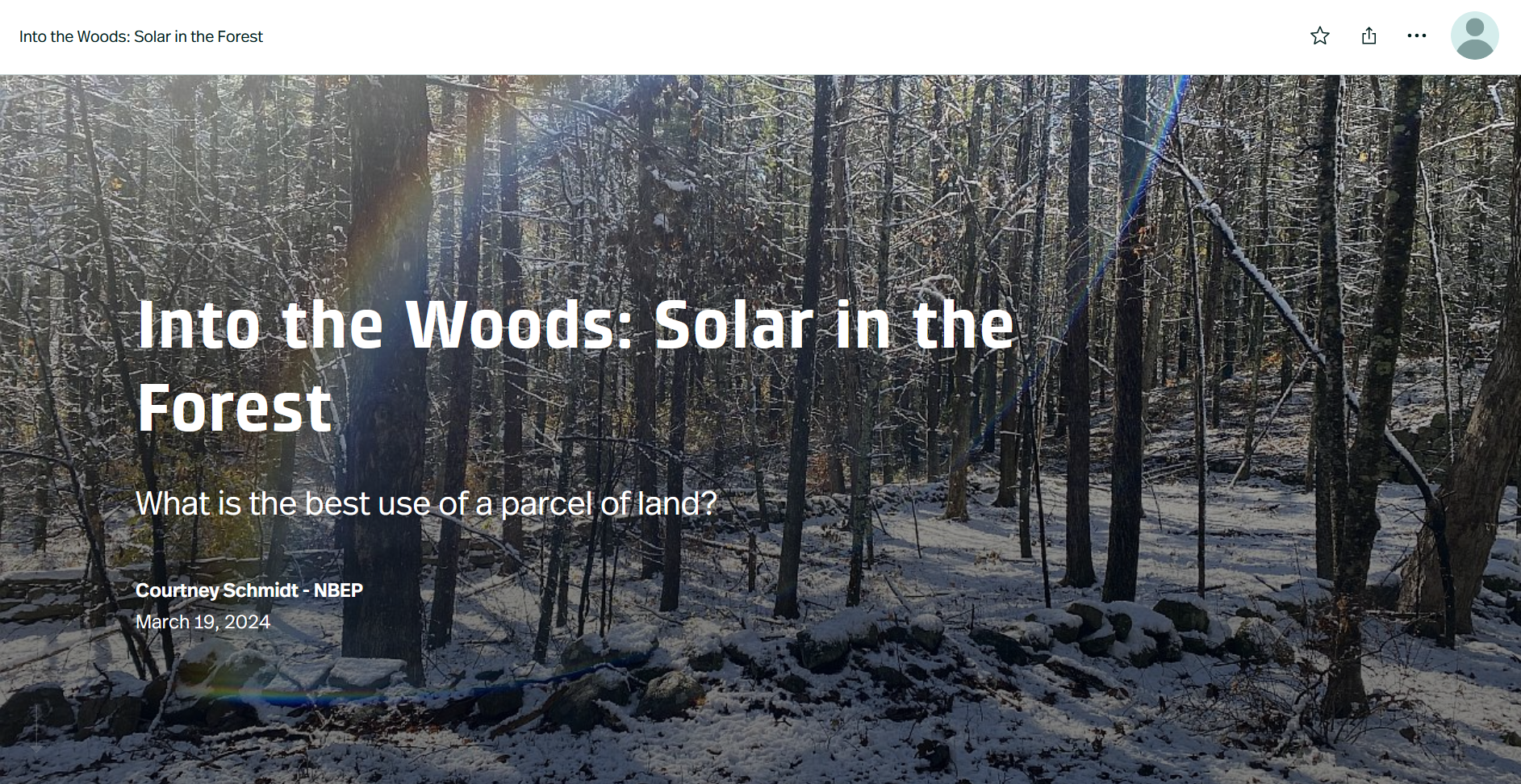
Into the Woods: Solar in the Forest
Balancing the need for solar and forest has been a top priority for the Narragansett Bay Estuary Program. Click through the Storymap to learn more about the number and location of solar projects in the region, as well as how much undeveloped land was lost to solar development.

Accessibility Within the Narragansett Bay Watershed
Water access is not universally accessible. Individuals with mobility challenges often struggle to find suitable access points. Explore this Storymap to learn more about which access points in both the Blackstone, and the larger Narragansett Bay Region are ADA accessible.
Interactive Maps

MA DER’s Dam Removal and Ecological Benefit Estimation Tool
This tool maps dams across Massachusetts and assigns each dam a score associated with the ecological benefit that dam removal would provide to the surrounding area.


Southeast New England Stewardship Mapping (STEW-MAP)
This dashboard outlines where different environmental groups work in Southeast New England. It includes information about their knowledge and funding networks as well.
RIDOT Stormwater Program
This online map provides information on stormwater programs in Rhode Island including the Stormwater Control Plan status and the Stormwater Treatment Unit (STU) Points.
Narragansett Bay Commission CSO Alarm Map

This interactive map shows the Combined Sewer Overflow (CSO) events within the Narragansett Bay Region.
Click here to sign up for CSO overflow notifications in the Blackstone!
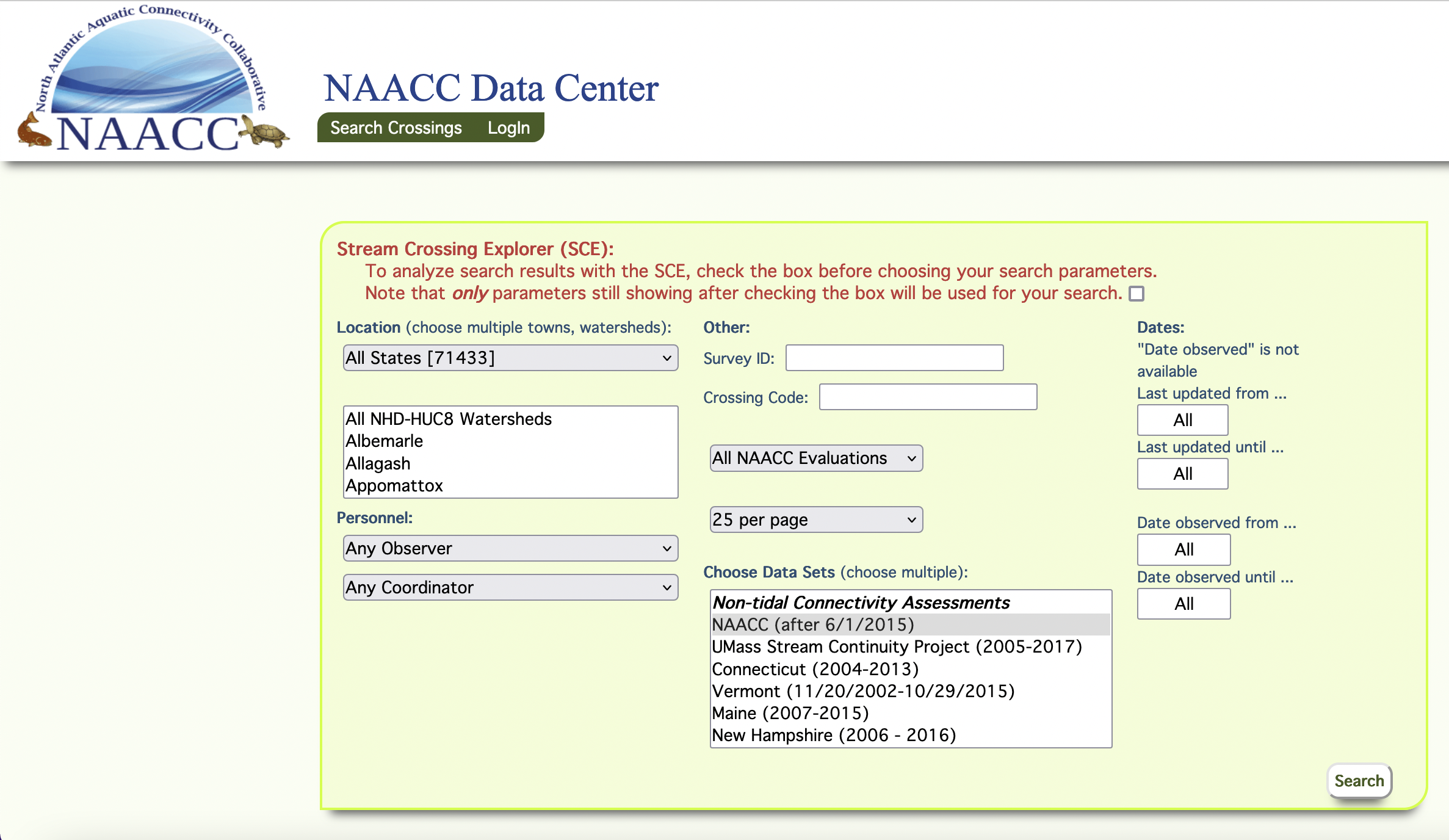
NAACC Stream Crossing Explorer
The Resilient Mass Metric Dashboard allows you to explore the Commonwealth’s progress towards achieving a resilient future. Within each sector, select a specific resilience goal to view a drop-down of the key strategies, progress indicators, and metrics tied to that goal’s advancement. .
This tool allows users to view stream crossing data from the 13-state region, including MA and RI. Search by watershed or town..

Environmental Justice Reference & Planning Tool
This tool from the Narragansett Bay Estuary Program (NBEP) helps planners characterizes the demographics of a project area for the purposes of helping to locate, characterize, and prioritize communities where the impacts of environmental hazards could be intensified.

CMMPO Culvert Assessment Program Hub
This resource from the Central MA Regional Planning Agency (CMRPC) provides information and guidance to culvert assessments in the planning region through various data, maps, and dashboards. (Note: this does not completely overlap with the Blackstone Watershed.)

BloomWatch
BloomWatch is a global cyanobacteria reporting hub. By downloading the app, you can contribute to cyanobacteria data collection. View data and results using the BloomWatch dashboard.

Landscape Scale Restoration Project Eligibility & Project Planning Tool
Landscape scale restoration projects focus on non-industrial private forest land and state forest land that is also rural. Use this tool to identify geographically eligible rural areas or explore how your project compliments other landscape initiatives.

NBEP Funded Projects
Explore past and present NBEP projects and their funding sources. This interactive map includes the category, year, funding, and completion status.
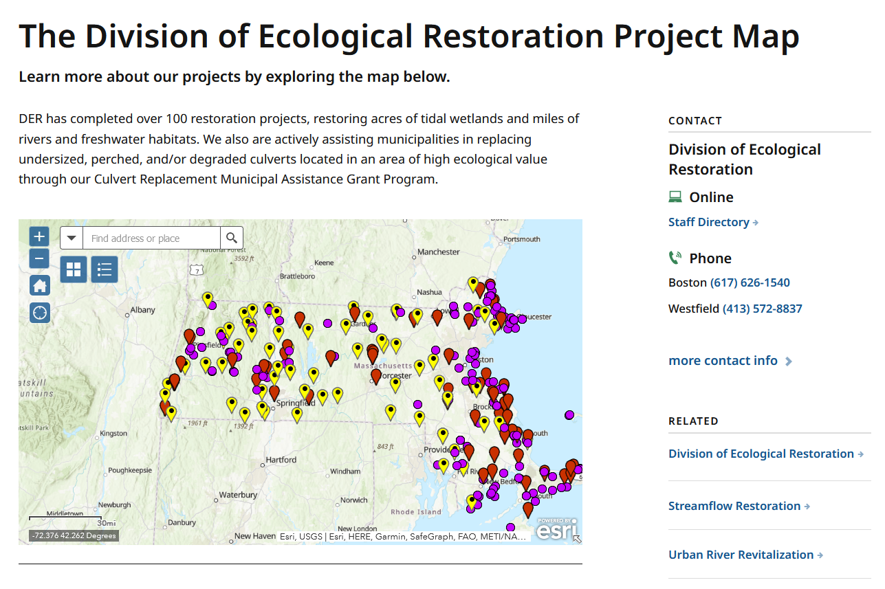
The Division of Ecological Restoration Project Map
The MA Division of Ecological Restoration (DER) has completed over 100 restoration projects.
Check out the interactive map to learn more!

Resilience Worcester- Heat Map
The Global Lab at WPI has created an interactive heat map of Worcester that shows how the urban heat island effect impacts communities at different times of day.

GEAR Maps for MVP Pilot
The GEAR statewide resource maps the conditions that shape how people are affected by climate hazards as some may be more exposed to climate impacts, face greater challenges or have fewer resources at their disposal to adapt, cope, or recover

Blackstone River Coalition Water Quality Data
Explore close to 20 years of water quality data for the entire Blackstone Watershed from 2003-2019 through this interactive map from the Blackstone River Coalition.

EcoAssess
EcoAssess is a web app that allows you to easily view the Index of Ecological Integrity (IEI) and ecoConnect across the Northeast to map landscape and habitat connectivity. The app includes a site scoring tool that produces a report with IEI and ecoConnect scores for a project area, either drawn on the map or uploaded as a shapefile.
Resilient Mass Metrics Dashboard

Student Mapping Projects

Patterns of Solar Field Development in the Blackstone Watershed
Adlai Nelson & Finnegan Wertz
Clark University 2023
Prioritizing Dam and Culvert Restoration in the Blackstone Watershed

Claudia Buszta
Clark University 2022

Blackstone Watershed Collaborative Basemaps
Caleigh McLaren
Clark University 2022

Wetland Loss and Chronic Flooding in Green Island, Worcester
HERO Cohort ‘21-’22
David Henriques, Caleigh McLaren, Sarah Hughes, Apple Gould-Shultz, & Madeline Regenye
Advised by: John Rogan, Nick Geron, & Marc Healy
Clark University 2021
Other Resources

RI DEM Maps
Explore the various tools and interactive maps that RI DEM has to offer!

FEMA Flood Maps
Enter a location and find current and past FEMA Flood Maps for that area.

BIOMAP
BioMap is an important tool to guide strategic protection and stewardship of lands and waters that are most important for conserving biological diversity in Massachusetts.

MassGIS
Download various free, state-wide datasets for Massachusetts using MassGIS, or view the data in online map via MassMapper.

RI GIS
Download various free, state-wide datasets for Rhode Island using RI GIS.